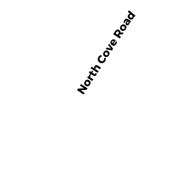
1 NORTH COVE ROAD
Owner Information
LAUREN GORFINKLE
1 NORTH COVE ROAD
STERLING, MA 01564


Property Details
1 NORTH COVE ROAD is classified as a Two-Family Residential (Colonial).
The primary structure on this property was built in 1983. There are 3,504ft2 of built area within this property. There is 1,852ft2 of residential/living space within this property. This property is listed as having 7 rooms.
1 NORTH COVE ROAD is valued at $390,500. The land is valued at $162,300 and the structures are valued at $206,500. There is an additional valuation of $21,700 on this property.
This property is in Zone RRF. Confirm with local Zoning Board authorities to ensure there are no overlays or other easements on this property.
The most recent deed for 1 NORTH COVE ROAD is recorded at the local registrar in Book 63068, Page 341. 1 NORTH COVE ROAD was last sold on Thursday, August 20, 2020 for $542,000.
Assessment data from fiscal year 2022.
Flood Data
According to the FEMA National Flood Hazard Layer, this property does not appear to be in a flood zone. It may also be in an area not yet reviewed. Nonetheless, confirm this information prior to taking any action.
To view the flood hazards around this property, create a FEMA "Firmette" Map of the area around 1 NORTH COVE ROAD.
Broadband Internet Providers
| Provider | Type | Bandwidth (mbps) | |
|---|---|---|---|
| GCI Communication Corp. | Satellite | 0 | 0 |
| VSAT Systems, LLC. | Satellite | 2 | 1 |
| HughesNet | Satellite | 25 | 3 |
| Viasat Inc | Satellite | 100 | 3 |
| Verizon New England Inc. | DSL | 15 | 1 |
| Comcast | Cable | 1000 | 35 |
| T-Mobile | Fixed Wireless | 25 | 3 |
Broadband service provider data from December 2020.
Adjacent Properties
- 11 NORTH COVE ROAD
Developable Residential Land owned by CIESLUK, PAUL D - 13 NORTH COVE ROAD
Developable Residential Land owned by FARMER, ROBERT F - 0 SWETT HILL ROAD
Vacant, Selectmen or City Council (Municipal) owned by STERLING TOWN OF - 9 SWETT HILL ROAD
Single Family Residential owned by CULLINANE WILLIAM S - 0 KENDALL HILL ROAD
Undevelopable Residential Land owned by EDWARD J THOMAS & PATRICIA L THOMAS, TRUSTEES - 93 KENDALL HILL ROAD
Mixed Use (Primarily Residential, some Agriculture) owned by WILBUR DAVID